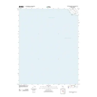
2012 Map of Stewarts Point OE W
USGS Topo · Published 2012About this map
The rugged coast of Sonoma County meets the Pacific Ocean in this coastal survey, where the terrestrial landscape is limited to a small corner of the quadrangle. The map highlights the prominent Del Mar Point and the adjacent settlement at Del Mar Landing, which served as a critical interface between the seafloor and the rising cliffs. In the 2010s, this area reflects the intersection of coastal topography and modern infrastructure, including the winding path of Deer Trl. Most of the sheet is dedicated to the open ocean, emphasizing the geographical isolation of this particular stretch of the California shoreline.
Find a feature on this map
4 named features on this map. Tap any name to fly to it.
Don’t see what you’re looking for? This feature index may not catch every label — zoom into the map to look around manually.
Map Details
Editions of this 2012 Stewarts Point OE W Map
This is the sole edition of this map. No revisions or reprints were ever made.
Other maps of this area

1921 · Plantation
USGS Topo · 1:62,500

1943 · Point Arena
USGS Topo · 1:62,500

1943 · Stewarts Point
USGS Topo · 1:24,000

1943 · Ornbaun
USGS Topo · 1:62,500

1944 · Stewarts Point
USGS Topo · 1:31,680

1944 · Ornbaun
USGS Topo · 1:62,500

1947 · Santa Rosa
USGS Topo · 1:250,000

1949 · Santa Rosa
USGS Topo · 1:250,000

1958 · Santa Rosa
USGS Topo · 1:250,000

1960 · Saunders Reef
USGS Topo · 1:24,000