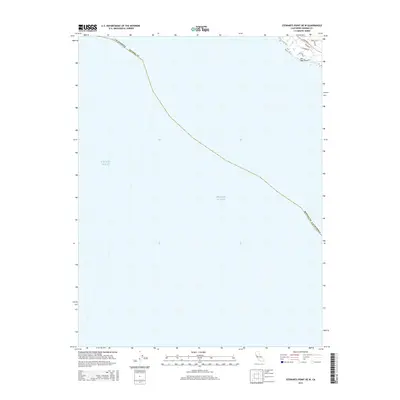
2015 Map of Stewarts Point OE W
USGS Topo · Published 2015About this map
Pacific Ocean waters dominate this coastal survey, where the terrestrial portion of Sonoma County is confined to a small wedge in the northeastern corner. The shoreline is defined by the prominent Del Mar Point, a rugged outcropping that marks the transition from the open sea to a developing coastal residential landscape. This corner of the map captures the contemporary road network just inland from the bluffs, centered around the iconic S Highway 1. The layout of local streets such as Deer Trail Rd, Leeward Rd, and Tallgrass illustrates the modern residential subdivision patterns typical of the Northern California coast. Most of the sheet is dedicated to the vast expanse of the ocean, providing a clear view of the state and county maritime boundaries that parallel the shoreline.
Find a feature on this map
9 named features on this map. Tap any name to fly to it.
Don’t see what you’re looking for? This feature index may not catch every label — zoom into the map to look around manually.
Map Details
Editions of this 2015 Stewarts Point OE W Map
This is the sole edition of this map. No revisions or reprints were ever made.
Other maps of this area

1921 · Plantation
USGS Topo · 1:62,500

1943 · Point Arena
USGS Topo · 1:62,500

1943 · Stewarts Point
USGS Topo · 1:24,000

1943 · Ornbaun
USGS Topo · 1:62,500

1944 · Stewarts Point
USGS Topo · 1:31,680

1944 · Ornbaun
USGS Topo · 1:62,500

1947 · Santa Rosa
USGS Topo · 1:250,000

1949 · Santa Rosa
USGS Topo · 1:250,000

1958 · Santa Rosa
USGS Topo · 1:250,000

1960 · Saunders Reef
USGS Topo · 1:24,000