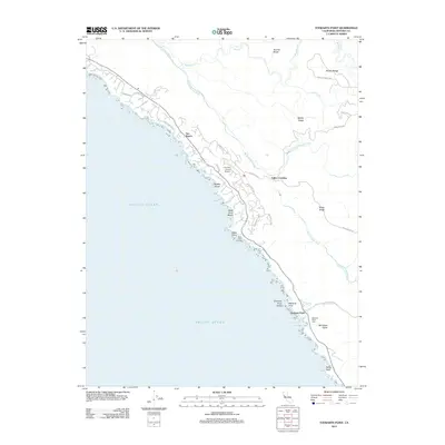
2012 Map of Stewarts Point
USGS Topo · Published 2012About this map
Sea Ranch and the Sonoma coast are defined here by a network of ridges and coastal terraces as they appeared in 2012. The landscape transitions from the shoreline at Black Point Beach and Pebble Beach toward the interior heights of Stanley Ridge and Brushy Ridge. This specific era captures the planned residential roads of the coastal community, including Leeward Rd and Moonraker Rd, alongside the essential aviation hub at The Sea Ranch Airport.
Find a feature on this map
34 named features on this map. Tap any name to fly to it.
Don’t see what you’re looking for? This feature index may not catch every label — zoom into the map to look around manually.
Map Details
Editions of this 2012 Stewarts Point Map
This is the sole edition of this map. No revisions or reprints were ever made.
Other maps of this area

1921 · Plantation
USGS Topo · 1:62,500

1943 · Point Arena
USGS Topo · 1:62,500

1943 · Stewarts Point
USGS Topo · 1:24,000

1943 · Plantation
USGS Topo · 1:24,000

1943 · Annapolis
USGS Topo · 1:24,000

1943 · Ornbaun
USGS Topo · 1:62,500

1944 · Annapolis
USGS Topo · 1:31,680
1944 · Plantation
USGS Topo · 1:31,680

1944 · Stewarts Point
USGS Topo · 1:31,680

1944 · Ornbaun
USGS Topo · 1:62,500