
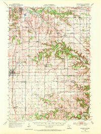
1955 Map of Stewartville
USGS Topo · Published 1956About this map
Stewartville and the surrounding agricultural landscapes of Olmsted, Mower, and Fillmore counties are documented here just after the mid-century. The map captures a high density of rural infrastructure, from the Institute of Experimental Medicine and Rochester Municipal Airport in the north near Golden Hill to the scattered country schoolhouses that anchored local life, such as Little Red Sch and St Bridget Sch. The topography is defined by the winding course of the North Branch Root River and South Fork Zumbro River, which carved deep valleys through the limestone-rich terrain, evidenced by numerous quarries and gravel pits dotted across the townships of Pleasant Grove and Marion. Genealogists will find a wealth of specific local landmarks, including the Holy Redeemer and Jerusalem cemeteries, alongside the path of the Chicago Great Western and Chicago and North Western railroads as they moved freight through towns like Racine and Simpson.
Find a feature on this map
84 named features on this map. Tap any name to fly to it.
Don’t see what you’re looking for? This feature index may not catch every label — zoom into the map to look around manually.
Map Details
Editions of this 1955 Stewartville Map
2 editions found
Other maps of this area

1934 · Plainview
USGS Topo · 1:62,500

1935 · Rochester
USGS Topo · 1:48,000

1938 · Plainview
USGS Topo · 1:62,500

1939 · Rochester
USGS Topo · 1:62,500

1953 · Saint Paul
USGS Topo · 1:250,000

1954 · Chatfield
USGS Topo · 1:62,500

1954 · Mason City
USGS Topo · 1:250,000

1955 · High Forest
USGS Topo · 1:62,500

1957 · Mason City
USGS Topo · 1:250,000

1958 · Mason City
USGS Topo · 1:250,000