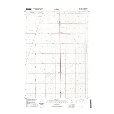
2015 Map of Still Lake SE
USGS Topo · Published 2015About this map
Coteau des Prairies defines the geography of this Codington County landscape, where glacial landforms create a subtle rolling topography. The region is marked by a precise grid of sectional roads, including 157th St and 455th Ave, which connect isolated rural landmarks. Small, local burial grounds serve as primary indicators of the area's early settlement history, such as Saint Luke's Lutheran Cem and Klix Cem in the north, and Saint John's Cem situated further south near the intermittent flow of Mud Cr. Drainage patterns are dictated by the prairie's unique elevation, with Mahoney Cr winding through the western sections. The map reveals a strictly agricultural layout, where life is organized around these small community anchors and the natural drainages that cross the townships.
Find a feature on this map
32 named features on this map. Tap any name to fly to it.
Don’t see what you’re looking for? This feature index may not catch every label — zoom into the map to look around manually.
Map Details
Editions of this 2015 Still Lake SE Map
This is the sole edition of this map. No revisions or reprints were ever made.
Other maps of this area

1953 · Milbank
USGS Topo · 1:250,000

1953 · Watertown
USGS Topo · 1:250,000

1958 · Milbank
USGS Topo · 1:250,000

1958 · Watertown
USGS Topo · 1:250,000

1969 · Watertown West
USGS Topo · 1:24,000

1969 · Watertown East
USGS Topo · 1:24,000

1970 · Kranzburg
USGS Topo · 1:24,000

1970 · Lonesome Lake
USGS Topo · 1:24,000

1970 · Still Lake SE
USGS Topo · 1:24,000

1970 · Still Lake NE
USGS Topo · 1:24,000
Featured Places
- Germantown Township, SD
- Enemy Swim District, SD
- Leola Township, SD
- Big Course District, SD
- Rauville Township, SD