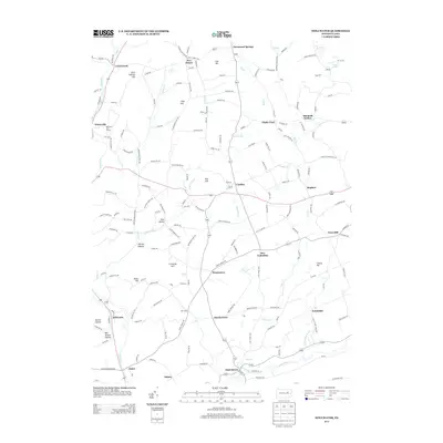
2013 Map of Stillwater
USGS Topo · Published 2013About this map
Fishing Cr and its tributaries carve a network of valleys through northern Pennsylvania, anchoring settlements such as Stillwater and New Columbus. This landscape is defined by its numerous small communities and named ridges, where local family names often identify the terrain, such as Saint Gabriel Hill, Hess Hill, and Creveling Hill. The southern edge of the map follows the winding course of Huntington Cr near Jonestown, where Kingsbury Brook joins the larger stream. The region's geography is notably segmented by named hollows, including Karnes Hollow and the evocatively named Bee Sellers Hollow, illustrating a long history of local place-naming. In the northwest, the Mill Race Golf Course near Waterville represents more modern land use amidst the traditional rural crossroads like Five Points and Fairmount Springs.
Find a feature on this map
168 named features on this map. Tap any name to fly to it.
Don’t see what you’re looking for? This feature index may not catch every label — zoom into the map to look around manually.
Map Details
Editions of this 2013 Stillwater Map
This is the sole edition of this map. No revisions or reprints were ever made.
Other maps of this area

1891 · Harveys Lake
USGS Topo · 1:62,500

1893 · Harvey Lake
USGS Topo · 1:62,500

1894 · Shickshinny
USGS Topo · 1:62,500

1894 · Bloomsburg
USGS Topo · 1:62,500

1934 · Laporte
USGS Topo · 1:62,500

1946 · Shickshinny
USGS Topo · 1:31,680

1946 · Berwick
USGS Topo · 1:31,680

1946 · Sweet Valley
USGS Topo · 1:24,000

1947 · Bloomsburg
USGS Topo · 1:24,000

1947 · Stillwater
USGS Topo · 1:24,000
Featured Places
- New Columbus, PA
- Stillwater, PA
- Honeytown, Fishing Creek Township
- Register, Huntington Township
- Asbury, Fishing Creek Township