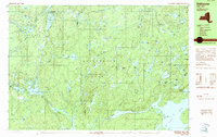
1989 Map of Stillwater
USGS Topo · Published 1989About this map
The remote forest interior of Adirondack Park is defined here by a dense network of glacial ponds and the winding paths of the West Branch and Middle Branch Oswegatchie River. This late-1980s landscape remains largely undeveloped, centered on the small settlement of Stillwater and the seasonal Oswegatchie Camp. The terrain is characterized by complex hydrology, where named waters like Pepperbox Pond, Sunshine Pond, and Loon Hollow Pond are tucked into the drainages of Alder Brook and Martin Creek. A Gaging Station on the river serves as a rare industrial marker in an area primarily used for conservation and recreation. The mapping of Four Mile Road and various trails suggests the limited reach of automobile infrastructure in this corner of Herkimer and Lewis counties.
Find a feature on this map
77 named features on this map. Tap any name to fly to it.
Don’t see what you’re looking for? This feature index may not catch every label — zoom into the map to look around manually.
Map Details
Editions of this 1989 Stillwater Map
This is the sole edition of this map. No revisions or reprints were ever made.
Other maps of this area

1903 · Big Moose
USGS Topo · 1:62,500

1911 · Lowville
USGS Topo · 1:62,500

1912 · Number Four
USGS Topo · 1:62,500

1913 · Lowville
USGS Topo · 1:62,500

1913 · Lake Bonaparte
USGS Topo · 1:62,500

1915 · Number Four
USGS Topo · 1:62,500

1916 · Lake Bonaparte
USGS Topo · 1:62,500

1916 · Oswegatchie
USGS Topo · 1:62,500

1918 · Oswegatchie
USGS Topo · 1:62,500

1919 · Cranberry Lake
USGS Topo · 1:62,500