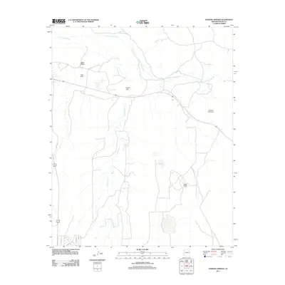
2011 Map of Stinking Springs
USGS Topo · Published 2011About this map
Greer Place sits at the heart of this high-desert landscape in Apache County, where the perennial path of the Little Colorado River defines the local drainage patterns. This 2011 survey illustrates a region where water is the primary architect of the settlement pattern, anchored by the namesake Stinking Springs to the north and various catchment features like Soda Lake and Rogers Lake to the west. The terrain is marked by distinctive geological formations, including the prominent rise of Volcanic Mountain and the elongated spine of Black Ridge. A network of rural roads, including Co RD 152 and several local drives, connects the scattered homesteads and ranching features. This map captures the modern character of the area, showing how contemporary infrastructure like Frontage Rd and the main highway corridor overlay the older natural landmarks and seasonal waterways like Concho Creek.
Find a feature on this map
14 named features on this map. Tap any name to fly to it.
Don’t see what you’re looking for? This feature index may not catch every label — zoom into the map to look around manually.
Map Details
Editions of this 2011 Stinking Springs Map
This is the sole edition of this map. No revisions or reprints were ever made.
Other maps of this area

1886 · St Johns
USGS Topo · 1:250,000

1892 · St Johns
USGS Topo · 1:250,000

1954 · Saint Johns
USGS Topo · 1:250,000

1955 · Adamana 4 SW
USGS Topo · 1:24,000

1955 · Adamana 4 NE
USGS Topo · 1:24,000

1955 · Adamana 4 NW
USGS Topo · 1:24,000

1955 · Wolford Springs 3 NW
USGS Topo · 1:24,000

1955 · Adamana 4 SE
USGS Topo · 1:24,000

1955 · Wolford Springs 3 SW
USGS Topo · 1:24,000

1955 · Hunt
USGS Topo · 1:62,500