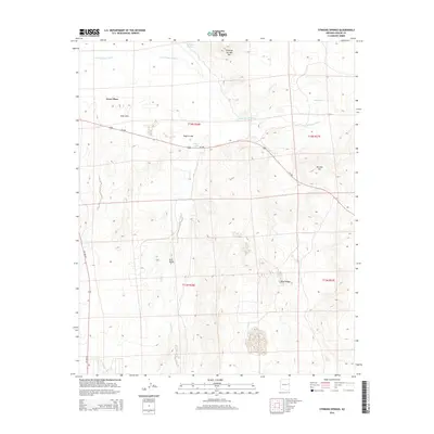
2014 Map of Stinking Springs
USGS Topo · Published 2014About this map
Little Colorado River meanders across this high-desert landscape in northern Arizona, shaping the hydrology of a region marked by ephemeral water and volcanic landforms. The ranching outpost at Greer Place sits west of Soda Lake, while the eponymous Stinking Springs and Stinking Springs Mtn dominate the northern portion of the quadrangle. The terrain transitions from the broad Hunt Valley to the dramatic heights of Volcanic Mtn and Black Ridge. Transportation is defined by the corridor of Us-180 and its alternate route, Az-180-Alt, which connect these scattered landmarks across the open range. Local drainage is further defined by Concho Cr and several distinct catchments like Rogers Lake and the Red Tank, reflecting the critical importance of water management in this arid environment.
Find a feature on this map
17 named features on this map. Tap any name to fly to it.
Don’t see what you’re looking for? This feature index may not catch every label — zoom into the map to look around manually.
Map Details
Editions of this 2014 Stinking Springs Map
This is the sole edition of this map. No revisions or reprints were ever made.
Other maps of this area

1886 · St Johns
USGS Topo · 1:250,000

1892 · St Johns
USGS Topo · 1:250,000

1954 · Saint Johns
USGS Topo · 1:250,000

1955 · Adamana 4 SW
USGS Topo · 1:24,000

1955 · Adamana 4 NE
USGS Topo · 1:24,000

1955 · Adamana 4 NW
USGS Topo · 1:24,000

1955 · Wolford Springs 3 NW
USGS Topo · 1:24,000

1955 · Adamana 4 SE
USGS Topo · 1:24,000

1955 · Wolford Springs 3 SW
USGS Topo · 1:24,000

1955 · Hunt
USGS Topo · 1:62,500