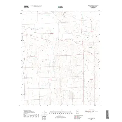
2018 Map of Stinking Springs
USGS Topo · Published 2018About this map
The Little Colorado River winds through this high-desert landscape in Apache County, creating a distinct riparian corridor through the Hunt Valley. This 2018 survey reveals a terrain defined by volcanic geography and ephemeral water sources, centered on the landmark Stinking Springs Mtn and the nearby Stinking Springs. The presence of large alkali flats and seasonal basins like Soda Lake and Rogers Lake highlights the arid hydrology of the region, where water management is crucial for the surrounding cattle country.
Find a feature on this map
16 named features on this map. Tap any name to fly to it.
Don’t see what you’re looking for? This feature index may not catch every label — zoom into the map to look around manually.
Map Details
Editions of this 2018 Stinking Springs Map
This is the sole edition of this map. No revisions or reprints were ever made.
Other maps of this area

1886 · St Johns
USGS Topo · 1:250,000

1892 · St Johns
USGS Topo · 1:250,000

1954 · Saint Johns
USGS Topo · 1:250,000

1955 · Adamana 4 SW
USGS Topo · 1:24,000

1955 · Adamana 4 NE
USGS Topo · 1:24,000

1955 · Adamana 4 NW
USGS Topo · 1:24,000

1955 · Wolford Springs 3 NW
USGS Topo · 1:24,000

1955 · Adamana 4 SE
USGS Topo · 1:24,000

1955 · Wolford Springs 3 SW
USGS Topo · 1:24,000

1955 · Hunt
USGS Topo · 1:62,500