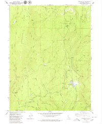
1979 Map of Stirling City
USGS Topo · Published 1979About this map
The timber and mining landscape of Northern California is captured here in the late 1970s, focused on Stirling City and the surrounding reaches of the Lassen National Forest. The geography is defined by the steep descent toward Butte Creek and the West Branch Feather River, where an intricate system of hydraulic engineering is visible. A network of water infrastructure including the Hendricks Canal, several flumes, and the Breedlove Reservoir illustrates the area's industrial reliance on water transport for resource extraction.
Find a feature on this map
62 named features on this map. Tap any name to fly to it.
Don’t see what you’re looking for? This feature index may not catch every label — zoom into the map to look around manually.
Map Details
Editions of this 1979 Stirling City Map
2 editions found
Other maps of this area

1886 · Lassen Peak
USGS Topo · 1:250,000

1888 · Bidwell Bar
USGS Topo · 1:125,000

1891 · Bidwell Bar
USGS Topo · 1:125,000

1891 · Chico
USGS Topo · 1:125,000

1892 · Lassen Peak
USGS Topo · 1:250,000

1893 · Chico
USGS Topo · 1:125,000

1893 · Bidwell Bar
USGS Topo · 1:125,000

1894 · Lassen Peak
USGS Topo · 1:250,000

1895 · Bidwell Bar
USGS Topo · 1:125,000

1895 · Chico
USGS Topo · 1:125,000