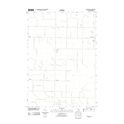
2011 Map of Stittsville
USGS Topo · Published 2011About this map
The West Branch Muskegon River winds through the southwestern corner of this Missaukee County landscape, anchoring a rural topography defined by small settlements and historic burial grounds. Stittsville and Moorestown serve as central points in the township’s grid, which is largely organized around agricultural and timber lands. The area is notable for its numerous family and community sites, including the Stittsville Cemetery, the Pioneer Cemetery, and the West Branch Cemetery near the river. Local aviation is represented by the Moorestown Airpark, while natural features like Fagan Lake and Dead Stream punctuate the northeastern section. Prominent elevations such as Baldy and Allen Hill rise above the surrounding terrain, providing a sense of the undulating glacial geography characteristic of northern Michigan. This survey documents the network of county roads, such as Turnerville Rd and N 7 Mile Rd, that connect these quiet outposts.
Find a feature on this map
43 named features on this map. Tap any name to fly to it.
Don’t see what you’re looking for? This feature index may not catch every label — zoom into the map to look around manually.
Map Details
Editions of this 2011 Stittsville Map
This is the sole edition of this map. No revisions or reprints were ever made.
Other maps of this area

1949 · Fletcher
USGS Topo · 1:62,500

1950 · Fletcher
USGS Topo · 1:24,000

1954 · Traverse City
USGS Topo · 1:250,000

1956 · Kalkaska
USGS Topo · 1:62,500

1956 · Houghton Lake
USGS Topo · 1:62,500

1956 · Lake City
USGS Topo · 1:62,500

1958 · Traverse City
USGS Topo · 1:250,000

1983 · Cadillac
USGS Topo · 1:100,000

1983 · Stittsville
USGS Topo · 1:24,000

1983 · Lake City
USGS Topo · 1:25,000