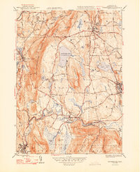
1948 Map of Stockbridge
USGS Topo · Published 1948About this map
The Housatonic River winds through the heart of this Berkshire County landscape, defining the industrial and social development of towns like Stockbridge and Lee. In the years following World War II, the area maintained a distinct balance between its manufacturing roots and its growing identity as a cultural destination. The world-renowned Tanglewood estate sits near the shores of the Stockbridge Bowl (Lake Mahkeenac), while the dual presence of the Boston & Albany RR and the New York New Haven and Hartford RR illustrates a region deeply connected by rail. Notable landmarks such as Laura Tower and the narrow passage at Burgoyne Pass offer touchpoints for local historians, while the numerous brooks like Konkapot Brook and Sepoese Brook reflect the intricate hydrology of the valley. From the heights of Monument Mountain to the quiet village of Interlaken, the map captures a mature New England community before modern suburban expansion.
Find a feature on this map
86 named features on this map. Tap any name to fly to it.
Don’t see what you’re looking for? This feature index may not catch every label — zoom into the map to look around manually.
Map Details
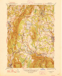
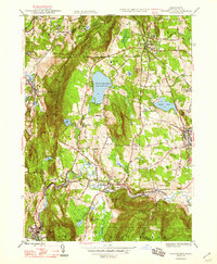
Editions of this 1948 Stockbridge Map
3 editions found
Other maps of this area

1885 · Sheffield
USGS Topo · 1:62,500

1886 · Becket
USGS Topo · 1:62,500

1888 · Sheffield
USGS Topo · 1:62,500

1888 · Becket
USGS Topo · 1:62,500

1888 · Sandisfield
USGS Topo · 1:62,500

1888 · Pittsfield
USGS Topo · 1:62,500

1890 · Pittsfield
USGS Topo · 1:62,500

1891 · Sheffield
USGS Topo · 1:62,500

1893 · Becket
USGS Topo · 1:62,500

1893 · Sheffield
USGS Topo · 1:62,500