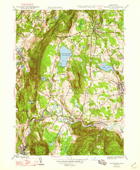
1948 Map of Stockbridge
USGS Topo · Published 1948About this map
Tanglewood and the surrounding cultural landscape of the Berkshire Hills are captured here shortly after World War II, showing a region defined by its prominent estates, summer retreats, and the winding Housatonic River. The settlement pattern centers on historic villages like Stockbridge and Lenox, connected by the New York New Haven and Hartford railroad which follows the river valley through South Lee and Glendale. The map illustrates the geographical transition between the prominent ridges of Lenox Mountain and the deep valley floor, where large water bodies like the Stockbridge Bowl and Laurel Lake served as anchors for seasonal residents. Local industrial and agricultural traces are visible in the Gravel Pit near Lee and the network of local roads such as Hawthorne Road, providing a clear view of the area's mid-century character before modern development expanded these historic corridors.
Find a feature on this map
53 named features on this map. Tap any name to fly to it.
Don’t see what you’re looking for? This feature index may not catch every label — zoom into the map to look around manually.
Map Details
Editions of this 1948 Stockbridge Map
3 editions found
Other maps of this area

1885 · Sheffield
USGS Topo · 1:62,500

1886 · Becket
USGS Topo · 1:62,500

1888 · Sheffield
USGS Topo · 1:62,500

1888 · Becket
USGS Topo · 1:62,500

1888 · Sandisfield
USGS Topo · 1:62,500

1888 · Pittsfield
USGS Topo · 1:62,500

1890 · Pittsfield
USGS Topo · 1:62,500

1891 · Sheffield
USGS Topo · 1:62,500

1893 · Becket
USGS Topo · 1:62,500

1893 · Sheffield
USGS Topo · 1:62,500