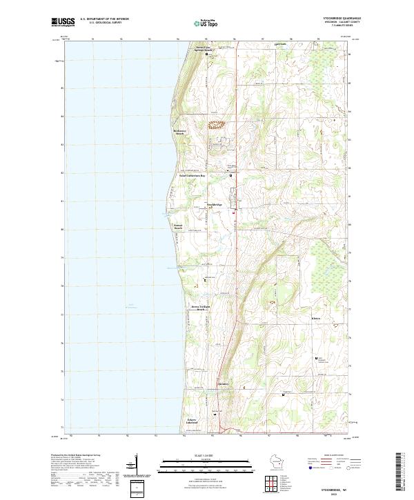
2022 Map of Stockbridge
USGS Topo · Published 2022About this map
The eastern shore of Lake Winnebago defines this Calumet County landscape, where small lakeside communities and agricultural tracts converge along the Niagara Escarpment ledge. The village of Stockbridge serves as a central hub, flanked by specialized shoreline settlements such as Rockaway Beach and Saint Catherines Bay. This area is particularly notable for its concentration of burial sites, including the Indian Cem and several family or denominational grounds like the Dorn Family Cem and Saint Elizabeth Catholic Cem. The map reveals a transition from the water-oriented infrastructure at Stockbridge Harbor and Mud Creek Harbor to the inland hamlets of Quinney and Kloten. The landscape is etched by small waterways like Mill Cr and Johnson Cr, which drain westward from the higher elevations of the ledge toward the massive lake basin.
Find a feature on this map
67 named features on this map. Tap any name to fly to it.
Don’t see what you’re looking for? This feature index may not catch every label — zoom into the map to look around manually.
Map Details
Editions of this 2022 Stockbridge Map
This is the sole edition of this map. No revisions or reprints were ever made.
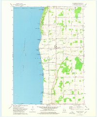
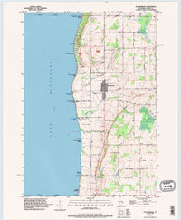
Historical Maps of Harrison Through Time
3 maps found