Old Maps of Stockbridge, Wisconsin
Explore 19 old maps of Stockbridge, spanning from 1911 to today. These high-resolution historic maps reveal how streets, neighborhoods, landmarks, and natural features evolved over time — perfect for genealogy, metal detecting, research, and local history exploration.
What you can do with these maps:
- See how Stockbridge changed over time: Compare historical maps to modern-day views to trace roads, homesites, rail lines & more.
- View detailed metadata: Each map includes creators, publishers, year, scale, and archive source.
- Overlay maps with satellite & LiDAR: Visualize the past alongside modern tools to explore terrain & human change.
- Trusted historical sources: Maps sourced from the USGS, Library of Congress, and other archives.
- Access maps your way: View online, download high-res files, or order prints for personal or research use.
Start exploring old maps of Stockbridge to uncover forgotten places, hidden landmarks, and the deep history beneath your feet.
Stockbridge, WI maps
(19)- 1911 Map of Neenah, 1949 Print
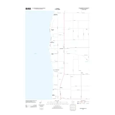
 1911 Neenah1949 Print · USGSThe Fox River Valley was a thriving industrial and social corridor at the dawn of the twentieth century. Genealogists and historians can trace the early layouts of Neenah and Menasha or locate vanished landmarks like High Cliff PO and the Limeworks.
 - 1954 Map of Chilton, 1956 Print
 1954 Chilton1956 Print · USGSMid-century Calumet County is captured here during a period of transition for its rural school districts and thriving rail corridors. Genealogists can locate family landmarks such as St Lukes Church, Brillion Cem, and several schoolhouses like the Howe Sch.3 unique versions available
 - 1955 Map of Neenah, 1957 Print
 1955 Neenah1957 Print · USGSMid-century Wisconsin comes to life along the Fox River and Lake Winnebago as industrial towns like Neenah and Menasha expand. Genealogists and historians can trace old property lines near St Marys Cem or locate defunct landmarks like the Drive-in Theater and Clay Sch.3 unique versions available
 - 1955 Map of Green Bay, 1968 Print
 1955 Green Bay1968 Print · USGSCentral and Eastern Wisconsin are captured here in the mid-fifties, showing the industrial growth of the Fox Valley and Wisconsin River corridors. Genealogists and historians can trace rail lines like the Green Bay and Western through settlements like Weyauwega, Clintonville, and Pulaski.2 unique versions available
 - 1974 Map of Chilton, 1977 Print
 1974 Chilton1977 Print · USGSCalumet County in the mid-seventies remains a vital rail and agricultural hub centered on the city of Chilton. Genealogists and local historians can trace family-named roads like Ortlepp Road and Lau Road, or locate rural landmarks such as St Lukes Ch and Portland Cem.
 - 1974 Map of Stockbridge, 1978 Print
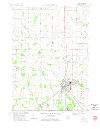
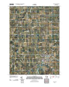
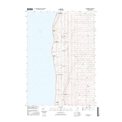
 1974 Stockbridge1978 Print · USGSThe eastern shore of Lake Winnebago is captured in the mid-1970s, showing a landscape defined by treaty boundaries and lakefront life. Genealogists can trace family names at Pingel Cem or Dorn Cem, and locate the old Indian Cem near Stockbridge.
 - 1984 Map of Appleton, 1985 Print
 1984 Appleton1985 Print · USGSThe Fox River Valley in the mid-eighties shows a bustling corridor of industry and nature, from the shores of Lake Winnebago to the Oneida Indian Reservation. Trace local heritage through landmarks like Riverside Cem or explore the wetlands of Poygan Marsh State Wildlife Area.2 unique versions available
 - 1992 Map of Stockbridge, 1996 Print
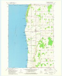
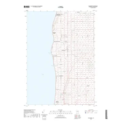
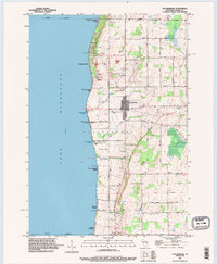 1992 Stockbridge1996 Print · USGSLake Winnebago's eastern shoreline in the 1990s reveals a blend of lakeside recreation and deep-rooted history. Genealogists can trace family sites through the Indian Cemetery, Pingel Cemetery, and the Old Indian Treaty Boundary.
 - 1992 Map of Chilton, 1996 Print
 1992 Chilton1996 Print · USGSCalumet County during the early nineties shows a landscape where historic boundaries and river junctions define the community layout. Genealogists can trace family connections at St Augustine Cemetery or locate the old Fairground and Hayton settlement.
 - 2010 Map of Stockbridge, 2010 Print
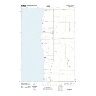 2010 Stockbridge2010 Print · USGSCovers Stockbridge, including Harrison, Brothertown, and other nearby areas
 - 2010 Map of Chilton, 2010 Print
 2010 Chilton2010 Print · USGSCovers Stockbridge, including Harrison, Chilton, and other nearby areas
 - 2013 Map of Stockbridge, 2013 Print
 2013 Stockbridge2013 Print · USGSCovers Stockbridge, including Harrison, Brothertown, and other nearby areas
 - 2013 Map of Chilton, 2013 Print
 2013 Chilton2013 Print · USGSCovers Stockbridge, including Harrison, Chilton, and other nearby areas
 - 2016 Map of Chilton, 2016 Print
 2016 Chilton2016 Print · USGSCovers Stockbridge, including Harrison, Chilton, and other nearby areas
 - 2016 Map of Stockbridge, 2016 Print
 2016 Stockbridge2016 Print · USGSCovers Stockbridge, including Harrison, Brothertown, and other nearby areas
 - 2018 Map of Stockbridge, 2018 Print
 2018 Stockbridge2018 Print · USGSCovers Stockbridge, including Harrison, Brothertown, and other nearby areas
 - 2018 Map of Chilton, 2018 Print
 2018 Chilton2018 Print · USGSCovers Stockbridge, including Harrison, Chilton, and other nearby areas
 - 2022 Map of Chilton, 2022 Print
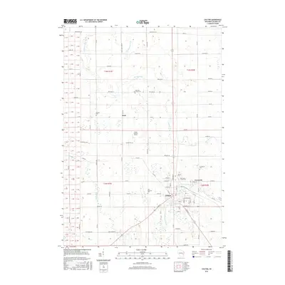
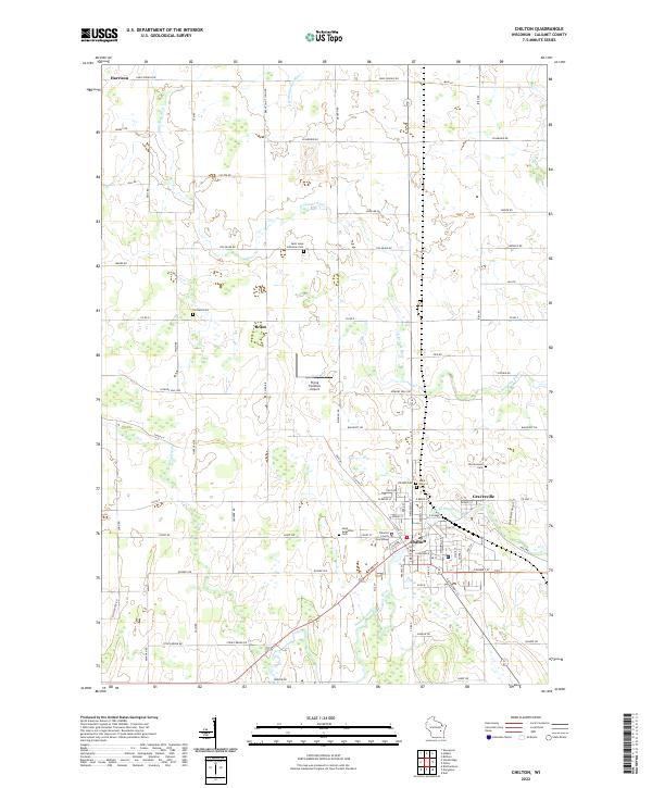 2022 Chilton2022 Print · USGSCalumet County's seat of government and its surrounding farmsteads are documented here in the early twenty-first century. Genealogists can trace family connections through numerous local burial grounds including Portland Cem, Saint Luke Lutheran Cem, and the Hillside Cem.
 - 2022 Map of Stockbridge, 2022 Print
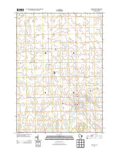
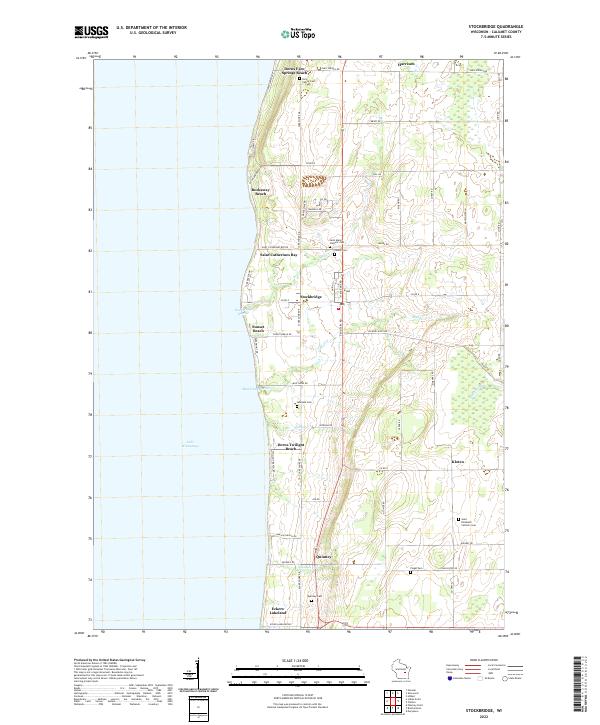 2022 Stockbridge2022 Print · USGSThe eastern shore of Lake Winnebago comes into focus in this recent survey of Calumet County. Genealogists and local researchers can trace a network of historic burial sites, from the Indian Cem and Quinney Cem to the family-named Dorn Family Cem.
End of results
Showing maps 1-19 of 19
Top cities near Stockbridge
- Appleton historical maps
- Neenah historical maps
- Grand Chute historical maps
- Fox Crossing historical maps
- Menasha historical maps
- Kaukauna historical maps
See more
Top neighborhoods of Stockbridge
- Eckers Lakeland historical maps
- Rockaway Beach historical maps
- Dorns Twilight Beach historical maps
- Kloten historical maps
- Dorns Faro Springs Beach historical maps
- Quinney historical maps
Frequently asked questions
- What are the different types of historical maps available for Stockbridge?
- What is the oldest map of Stockbridge?
- Where can I purchase historical maps of Stockbridge for my home or office?
- Where can I download high-res historical maps of Stockbridge?
- Are there historical topographic maps available for Stockbridge?
- Is there historical aerial imagery available for Stockbridge?
- Where are historical maps of Stockbridge sourced from?