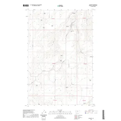
2020 Map of Stockett
USGS Topo · Published 2020About this map
Stockett and the neighboring settlement of Giffen are centered within a landscape of deep coulees and high benches in Cascade County. The terrain is defined by dramatic elevation changes, where features like Powderhouse Hill and Red Butte rise above the drainage networks of Sand Coulee Cr and Cottonwood Cr. The settlement pattern follows these natural contours, with roads like Stockett Rd and Giffen Rd tracing the paths through the coulees.
Find a feature on this map
36 named features on this map. Tap any name to fly to it.
Don’t see what you’re looking for? This feature index may not catch every label — zoom into the map to look around manually.
Map Details
Editions of this 2020 Stockett Map
This is the sole edition of this map. No revisions or reprints were ever made.
Other maps of this area

1886 · Great Falls
USGS Topo · 1:250,000

1954 · Great Falls
USGS Topo · 1:250,000

1955 · Stockett
USGS Topo · 1:62,500

1955 · Gore Hill
USGS Topo · 1:62,500

1957 · Great Falls
USGS Topo · 1:250,000

1965 · Eden
USGS Topo · 1:24,000
1965 · Southeast Great Falls
USGS Topo · 1:24,000
1965 · Fife
USGS Topo · 1:24,000
1965 · Stockett
USGS Topo · 1:24,000

1965 · Mahoney Hill
USGS Topo · 1:24,000