
1965 Map of Eden
USGS Topo · Published 1967About this map
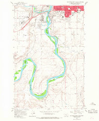
Eden stands at the heart of this mid-1960s landscape, positioned near the confluence of several deep-cut drainages including Ming Coulee and Boston Coulee. The terrain is characterized by high, flat plateaus like Truly Bench and Swede Bench, which drop sharply into the complex network of draws and badlands below. This configuration suggests a cattle-ranching economy reliant on the scattered natural water sources identified as Spring and Springs across the sheet.
Find a feature on this map
25 named features on this map. Tap any name to fly to it.
Don’t see what you’re looking for? This feature index may not catch every label — zoom into the map to look around manually.
Map Details
Editions of this 1965 Eden Map
This is the sole edition of this map. No revisions or reprints were ever made.
Other maps of this area

1886 · Great Falls
USGS Topo · 1:250,000

1954 · Great Falls
USGS Topo · 1:250,000

1955 · Stockett
USGS Topo · 1:62,500

1955 · Gore Hill
USGS Topo · 1:62,500

1957 · Great Falls
USGS Topo · 1:250,000
1965 · Antelope Butte
USGS Topo · 1:24,000
1965 · Southeast Great Falls
USGS Topo · 1:24,000
1965 · Stockett
USGS Topo · 1:24,000
1965 · Truly
USGS Topo · 1:24,000
1965 · Southwest Great Falls
USGS Topo · 1:24,000