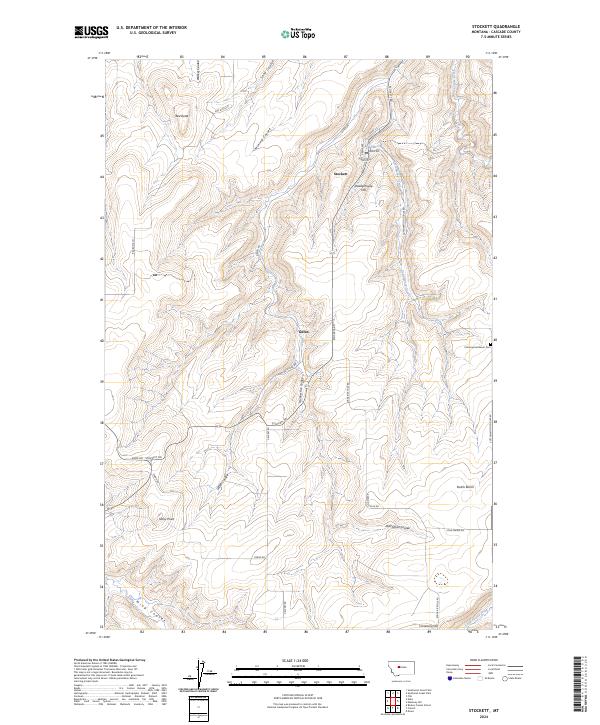
2024 Map of Stockett
USGS Topo · Published 2024About this map
The settlement of Stockett serves as a focal point in this portion of Cascade County, where the landscape is defined by an intricate network of coulees and ridges. The topography is shaped by watercourses like Mining Coulee and Sand Coulee, which cut through the high ground of Powderhouse Hill and Red Butte. This area has long been defined by its geography, with residential streets in the town center including Front St and Crane Ave giving way to the sprawling agricultural and ranching lands of Dutch Bench. To the south, smaller communities and points of interest such as Giffen and Creamery Hill are connected by a grid of rural roads like Evans Riceville Rd and Calvert Rd. The presence of the Cottonwood Bench Cem near Cottonwood Creek provides a significant touchstone for local genealogy, marking the enduring presence of families in this Montana landscape.
Find a feature on this map
36 named features on this map. Tap any name to fly to it.
Don’t see what you’re looking for? This feature index may not catch every label — zoom into the map to look around manually.
Map Details
Editions of this 2024 Stockett Map
This is the sole edition of this map. No revisions or reprints were ever made.
Other maps of this area

1886 · Great Falls
USGS Topo · 1:250,000

1954 · Great Falls
USGS Topo · 1:250,000

1955 · Stockett
USGS Topo · 1:62,500

1955 · Gore Hill
USGS Topo · 1:62,500

1957 · Great Falls
USGS Topo · 1:250,000

1965 · Eden
USGS Topo · 1:24,000
1965 · Southeast Great Falls
USGS Topo · 1:24,000
1965 · Fife
USGS Topo · 1:24,000
1965 · Stockett
USGS Topo · 1:24,000

1965 · Mahoney Hill
USGS Topo · 1:24,000