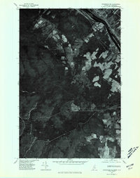
1975 Map of Stockholm NE
USGS Topo · Published 1981About this map
The international border between the Canada United States defines the northern edge of this 1975 orthophotomap, where the northernmost tip of Aroostook County meets the province of New Brunswick. The settlement of Parent sits along the riverfront, serving as a focal point for the agricultural clearings that break through the dense woodland. This aerial perspective highlights the stark geometry of the border and the transition from river-bottom farming to the timberlands of Northern Maine. Watercourses like Daigle Brook and Violette Stream cut through the forest, illustrating the natural drainage patterns that have historically shaped land use and logging in this remote borderland region.
Find a feature on this map
5 named features on this map. Tap any name to fly to it.
Don’t see what you’re looking for? This feature index may not catch every label — zoom into the map to look around manually.
Map Details
Editions of this 1975 Stockholm NE Map
This is the sole edition of this map. No revisions or reprints were ever made.
Other maps of this area

1921 · Van Buren
USGS Topo · 1:250,000

1927 · Stockholm
USGS Topo · 1:48,000

1931 · Van Buren
USGS Topo · 1:48,000

1931 · Stockholm
USGS Topo · 1:62,500

1934 · Van Buren
USGS Topo · 1:62,500

1938 · Grand Isle
USGS Topo · 1:62,500

1940 · Grand Isle
USGS Topo · 1:62,500

1951 · Van Buren
USGS Topo · 1:62,500

1953 · Stockholm
USGS Topo · 1:62,500

1962 · Edmundston
USGS Topo · 1:250,000