
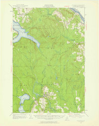
1953 Map of Stockholm
USGS Topo · Published 1954About this map
Stockholm stands as a focal point in this northern Aroostook County landscape, situated where the Bangor and Aroostook railroad network connects the timberlands with local industry. The map illustrates a region defined by its Swedish heritage and woods-based economy, with the village of Jemtland and Jemtland Sta serving the agricultural and logging interests of the era. The terrain is marked by significant elevations like Stockholm Mtn, which features a Fire Tower, and Cold Mtn to the north.
Find a feature on this map
49 named features on this map. Tap any name to fly to it.
Don’t see what you’re looking for? This feature index may not catch every label — zoom into the map to look around manually.
Map Details
Editions of this 1953 Stockholm Map
2 editions found
Other maps of this area

1921 · Van Buren
USGS Topo · 1:250,000

1927 · Stockholm
USGS Topo · 1:48,000

1927 · Square Lake
USGS Topo · 1:48,000

1929 · Portage
USGS Topo · 1:62,500

1929 · Caribou
USGS Topo · 1:48,000

1930 · Fort Fairfield
USGS Topo · 1:48,000

1931 · Square Lake
USGS Topo · 1:62,500

1931 · Van Buren
USGS Topo · 1:48,000

1931 · Portage
USGS Topo · 1:62,500

1931 · Stockholm
USGS Topo · 1:62,500