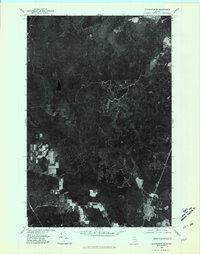
1975 Map of Stockholm SE
USGS Topo · Published 1981About this map
Little Madawaska River winds through the southwestern corner of this orthophotoquad, serving as a primary drainage for the dense woodlands of Aroostook County. This imagery, captured in the mid-1970s, reveals a landscape defined by industrial forestry and small-scale agriculture. The settlement of California appears as a small clearing in the timberland, connected by narrow logging roads and fire breaks. The network of waterways, including Halfway Brook and Violette Brook, illustrates the natural drainage patterns of this northern Maine territory. The visual contrast between the stark white rectangular clearings of recent harvests and the deep shadows of mature forest provide researchers with a direct look at land management and timber production before modern satellite technology became the standard for aerial observation.
Find a feature on this map
4 named features on this map. Tap any name to fly to it.
Don’t see what you’re looking for? This feature index may not catch every label — zoom into the map to look around manually.
Map Details
Editions of this 1975 Stockholm SE Map
This is the sole edition of this map. No revisions or reprints were ever made.
Other maps of this area

1921 · Van Buren
USGS Topo · 1:250,000

1927 · Stockholm
USGS Topo · 1:48,000

1929 · Caribou
USGS Topo · 1:48,000

1930 · Fort Fairfield
USGS Topo · 1:48,000

1931 · Van Buren
USGS Topo · 1:48,000

1931 · Stockholm
USGS Topo · 1:62,500

1932 · Caribou
USGS Topo · 1:62,500

1933 · Fort Fairfield
USGS Topo · 1:62,500

1934 · Van Buren
USGS Topo · 1:62,500

1951 · Van Buren
USGS Topo · 1:62,500