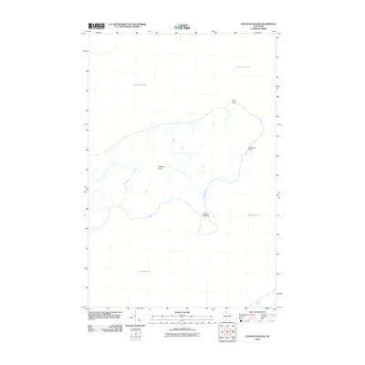
2010 Map of Stockton Island
USGS Topo · Published 2010About this map
Stockton Island emerges from the cold waters of Lake Superior in this topographical representation of one of the largest landmasses in the Apostle Islands. The island's geography is defined by its dramatic shoreline features, including the hooked peninsula of Presque Isle Point to the south and the northern reach of Trout Point. This 2010 survey reveals a landscape almost entirely shaped by natural forces and maritime proximity, where a network of inland streams drains toward the lake. The inclusion of Balancing Rock on the eastern coast highlights a specific geological landmark along the rocky perimeter that has long drawn visitors to this part of Ashland County. The map provides a clear view of the island’s interior drainages and elevation contours, which rise away from the beaches into a forested plateau.
Find a feature on this map
5 named features on this map. Tap any name to fly to it.
Don’t see what you’re looking for? This feature index may not catch every label — zoom into the map to look around manually.
Map Details
Editions of this 2010 Stockton Island Map
This is the sole edition of this map. No revisions or reprints were ever made.
Other maps of this area

1953 · Ashland
USGS Topo · 1:250,000

1954 · Two Harbors
USGS Topo · 1:250,000

1957 · Two Harbors
USGS Topo · 1:250,000

1958 · Ashland
USGS Topo · 1:250,000

1958 · Two Harbors
USGS Topo · 1:250,000
1963 · Outer Island
USGS Topo · 1:62,500

1963 · Cat Island
USGS Topo · 1:24,000

1963 · Michigan Island
USGS Topo · 1:24,000

1963 · Rocky Island
USGS Topo · 1:62,500
1963 · Outer Island
USGS Topo · 1:24,000