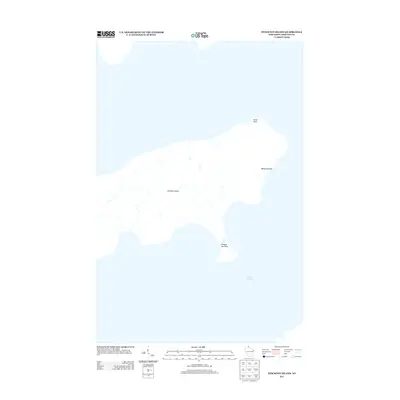
2013 Map of Stockton Island
USGS Topo · Published 2013About this map
Stockton Island rises from the cold waters of Lake Superior, showing a landscape defined by its isolated coastal features and natural drainage patterns. This 2013 survey identifies prominent landmarks along the shoreline, such as Trout Point at the northern tip and the distinctive peninsula of Presque Isle Point to the south. The interior is marked by numerous small streams that feed into the lake, illustrating the island's role in the local watershed. Notable coastal formations like Balancing Rock are also recorded, providing specific points of interest for those studying the geological and maritime geography of the Apostle Islands area. The absence of major roads or developed settlements highlights the primitive and preserved character of this island landmass.
Find a feature on this map
5 named features on this map. Tap any name to fly to it.
Don’t see what you’re looking for? This feature index may not catch every label — zoom into the map to look around manually.
Map Details
Editions of this 2013 Stockton Island Map
This is the sole edition of this map. No revisions or reprints were ever made.
Other maps of this area

1953 · Ashland
USGS Topo · 1:250,000

1954 · Two Harbors
USGS Topo · 1:250,000

1957 · Two Harbors
USGS Topo · 1:250,000

1958 · Ashland
USGS Topo · 1:250,000

1958 · Two Harbors
USGS Topo · 1:250,000
1963 · Outer Island
USGS Topo · 1:62,500

1963 · Cat Island
USGS Topo · 1:24,000

1963 · Michigan Island
USGS Topo · 1:24,000

1963 · Rocky Island
USGS Topo · 1:62,500
1963 · Outer Island
USGS Topo · 1:24,000