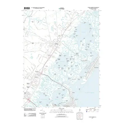
2011 Map of Stone Harbor
USGS Topo · Published 2011About this map
Cape May Court House serves as the inland hub of this coastal survey, where the Garden State Parkway and local routes like Stone Harbor Blvd provide passage toward the Atlantic barrier islands. The landscape is defined by the complex aquatic network of Great Sound, Jenkins Sound, and the Intracostal Waterway, which separates the mainland settlements of Mayville, Burleigh, and Whitesboro from the resort communities. The map detail highlights the numerous points and islands that character the marshlands, including Skeeter Island, Gull Island, and Nummy Island Creek. The transition from the mainland to the coast is marked by the Stone Harbor Bridge and the Stone Harbor Canal, illustrating the modern connectivity of this recreational and maritime region. Inland, the Fairview Memorial Cemetery and Wildwood Golf Course provide clear landmarks for local history and land use research.
Find a feature on this map
187 named features on this map. Tap any name to fly to it.
Don’t see what you’re looking for? This feature index may not catch every label — zoom into the map to look around manually.
Map Details
Editions of this 2011 Stone Harbor Map
This is the sole edition of this map. No revisions or reprints were ever made.
Other maps of this area

1884 · Sea Isle
USGS Topo · 1:62,500

1888 · Cape May
USGS Topo · 1:62,500

1888 · Dennisville
USGS Topo · 1:62,500

1888 · Sea Isle
USGS Topo · 1:62,500

1893 · Cape May
USGS Topo · 1:62,500

1894 · Dennisville
USGS Topo · 1:62,500

1894 · Sea Isle
USGS Topo · 1:62,500

1898 · Cape May
USGS Topo · 1:62,500

1918 · Cape May
USGS Topo · 1:62,500

1919 · Sea Isle
USGS Topo · 1:62,500