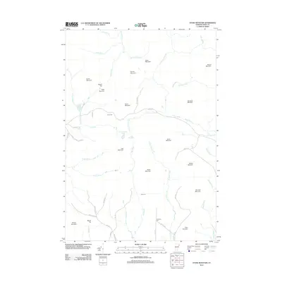
2012 Map of Stone Mountain
USGS Topo · Published 2012About this map
Stone Mountain stands at the heart of this Essex County landscape, presiding over a terrain defined by high peaks and the intricate drainage of the Connecticut River valley's upper reaches. The 2012 survey shows a network of local roads such as Granby Rd and Colby Rd that navigate the gaps between massive features like Burnside Mountain and Sheridan Mountain. For genealogists and local historians, the map preserves the exact locations of several small burial grounds, including Boyce Cem in the north and Stuart Cem and Spaulding Cem further south. The drainage patterns are particularly detailed, showing how Cutler Mill Brook and Catbow Brook thread through the valleys. The presence of features like Cow Mountain Pond and Little Mud Pond indicates the varied wetland environments found among these granite heights.
Find a feature on this map
59 named features on this map. Tap any name to fly to it.
Don’t see what you’re looking for? This feature index may not catch every label — zoom into the map to look around manually.
Map Details
Editions of this 2012 Stone Mountain Map
This is the sole edition of this map. No revisions or reprints were ever made.
Other maps of this area

1900 · Whitefield
USGS Topo · 1:62,500

1920 · Guildhall
USGS Topo · 1:62,500

1931 · Guildhall
USGS Topo · 1:48,000

1931 · Littleton
USGS Topo · 1:62,500

1932 · Littleton
USGS Topo · 1:48,000

1933 · Guildhall
USGS Topo · 1:48,000

1935 · Littleton
USGS Topo · 1:62,500

1935 · Whitefield
USGS Topo · 1:48,000

1937 · Guildhall
USGS Topo · 1:62,500

1938 · Whitefield
USGS Topo · 1:62,500