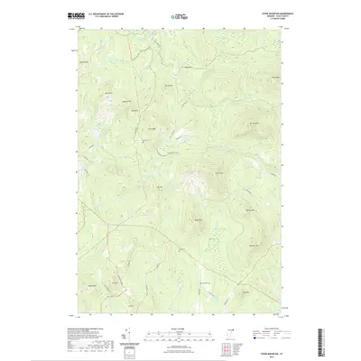
2021 Map of Stone Mountain
USGS Topo · Published 2021About this map
Stone Mtn and a series of high peaks dominate this Essex County landscape, where the terrain is carved by the drainages of Granby Stream and Cutler Mill Brook. The map reveals a high-elevation backcountry characterized by scattered water bodies like Cow Mountain Pond and Little Cow Pond, which sit nestled between ridges. Small cemeteries, including Boyce Cem, Stuart Cem, and Spaulding Cem, are the primary markers of historical settlement, often located near local thoroughfares such as Granby Rd or Cole Hill Rd. The network of timber and access roads like Paul Stream Rd and Tug Mountain Rd suggests a landscape managed for forestry and traditional mountain use. The density of named summits, from Sable Mtn in the north to Temple Mtn in the south, indicates a deeply traditional Vermont upland geography where family and place names define every significant landform.
Find a feature on this map
62 named features on this map. Tap any name to fly to it.
Don’t see what you’re looking for? This feature index may not catch every label — zoom into the map to look around manually.
Map Details
Editions of this 2021 Stone Mountain Map
This is the sole edition of this map. No revisions or reprints were ever made.
Other maps of this area

1900 · Whitefield
USGS Topo · 1:62,500

1920 · Guildhall
USGS Topo · 1:62,500

1931 · Guildhall
USGS Topo · 1:48,000

1931 · Littleton
USGS Topo · 1:62,500

1932 · Littleton
USGS Topo · 1:48,000

1933 · Guildhall
USGS Topo · 1:48,000

1935 · Littleton
USGS Topo · 1:62,500

1935 · Whitefield
USGS Topo · 1:48,000

1937 · Guildhall
USGS Topo · 1:62,500

1938 · Whitefield
USGS Topo · 1:62,500