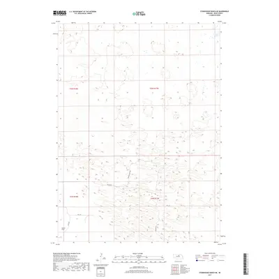
2017 Map of Stonehouse Ranch NE
USGS Topo · Published 2017About this map
Stonehouse Ranch and its various outposts sit within the distinctively ridged sandhills of northern Nebraska, as documented by the U.S. Geological Survey in 2017. The landscape is characterized by its isolation and the distribution of localized water features, such as Long Lake and Bruner Lake, which define the ranching operations here. To the southwest, Gracie Flats provides a rare stretch of level terrain amidst the undulating hills. A sparse network of unpaved corridors including Frontier Loop Rd and Falcon Ave connects the remote properties of Stonehouse Ranch SW and Stonehouse Ranch NW. The map reveals the intricate management of this arid environment, where water access and local roads dictate the survival of long-standing ranching estates.
Find a feature on this map
15 named features on this map. Tap any name to fly to it.
Don’t see what you’re looking for? This feature index may not catch every label — zoom into the map to look around manually.
Map Details
Editions of this 2017 Stonehouse Ranch NE Map
This is the sole edition of this map. No revisions or reprints were ever made.
Other maps of this area

1955 · O'Neill
USGS Topo · 1:250,000

1959 · O'Neill
USGS Topo · 1:250,000

1969 · O'Neill
USGS Topo · 1:250,000

1981 · Bruner Lake
USGS Topo · 1:24,000

1981 · Stonehouse Ranch NW
USGS Topo · 1:24,000

1981 · Stonehouse Ranch NE
USGS Topo · 1:24,000
1981 · Carson Lake
USGS Topo · 1:24,000
1981 · Stonehouse Ranch
USGS Topo · 1:24,000
1981 · Stonehouse Ranch SW
USGS Topo · 1:24,000

1982 · Stockdale Lake
USGS Topo · 1:24,000