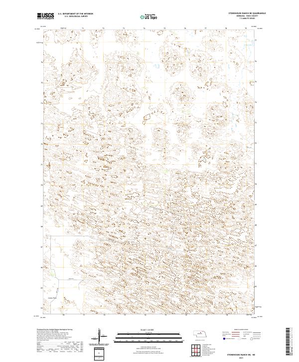
2021 Map of Stonehouse Ranch NE
USGS Topo · Published 2021About this map
Gracie Flats dominates the southwestern corner of this landscape in Rock County, Nebraska, where the terrain transitions into the complex dune structures characteristic of the region. This 2021 survey illustrates the sparse, high-plains settlement pattern defined by isolated section-line roads and seasonal water bodies. Long Lake sits in the northeastern corner, an example of the numerous small basins tucked between the sandy ridges. A handful of local routes, including Frontier Loop Rd, Falcon Ave, and Finch Rd, provide the only modern access across this portion of the Sandhills. The map detail reflects a remote ranching environment where large-scale land management is organized by the Public Land Survey System, as shown by the prominent township boundaries like t26n r17w and t25n r18w.
Find a feature on this map
10 named features on this map. Tap any name to fly to it.
Don’t see what you’re looking for? This feature index may not catch every label — zoom into the map to look around manually.
Map Details
Editions of this 2021 Stonehouse Ranch NE Map
This is the sole edition of this map. No revisions or reprints were ever made.
Other maps of this area

1955 · O'Neill
USGS Topo · 1:250,000

1959 · O'Neill
USGS Topo · 1:250,000

1969 · O'Neill
USGS Topo · 1:250,000

1981 · Bruner Lake
USGS Topo · 1:24,000

1981 · Stonehouse Ranch NW
USGS Topo · 1:24,000

1981 · Stonehouse Ranch NE
USGS Topo · 1:24,000
1981 · Carson Lake
USGS Topo · 1:24,000
1981 · Stonehouse Ranch
USGS Topo · 1:24,000
1981 · Stonehouse Ranch SW
USGS Topo · 1:24,000

1982 · Stockdale Lake
USGS Topo · 1:24,000