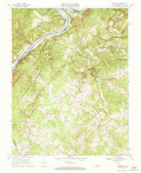
1968 Map of Stonewall
USGS Topo · Published 1971About this map
The James River carves a winding path along the northern edge of this Piedmont landscape, serving as the historical boundary between Amherst and Appomattox Counties. The river corridor is defined by the Chesapeake and Ohio railroad and the presence of Pettyjohn Island. Further inland, the terrain is deeply dissected by a network of waterways including Wreck Island Creek, Blackfoot Creek, and Halls Creek.
Find a feature on this map
32 named features on this map. Tap any name to fly to it.
Don’t see what you’re looking for? This feature index may not catch every label — zoom into the map to look around manually.
Map Details
Editions of this 1968 Stonewall Map
2 editions found
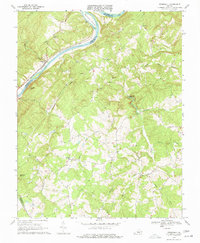
Other maps of this area

1892 · Lynchburg
USGS Topo · 1:125,000

1892 · Buckingham
USGS Topo · 1:125,000

1892 · Appomattox
USGS Topo · 1:125,000

1894 · Lexington
USGS Topo · 1:125,000

1935 · Amherst
USGS Topo · 1:48,000

1939 · Amherst
USGS Topo · 1:62,500

1944 · Lynchburg
USGS Topo · 1:62,500

1947 · Roanoke
USGS Topo · 1:250,000

1950 · Amherst
USGS Topo · 1:62,500

1950 · Lynchburg
USGS Topo · 1:62,500