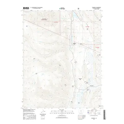
2016 Map of Stonewall
USGS Topo · Published 2016About this map
Stonewall sits at the intersection of mountain geography and ranching history, characterized by the dramatic namesake rock formation known as The Stonewall. This geological spine runs north-to-south, creating a natural barrier that defines the Stonewall Valley and Stonewall Gap. The settlement and surrounding lands are heavily influenced by the high-altitude hydrology of the San Isabel National Forest, where numerous drainages like the N Fork Purgatoire River and Middle Fork Purgatoire River feed a series of alpine waters including Monument Lake, North Lake, and Russell Reservoir.
Find a feature on this map
48 named features on this map. Tap any name to fly to it.
Don’t see what you’re looking for? This feature index may not catch every label — zoom into the map to look around manually.
Map Details
Editions of this 2016 Stonewall Map
This is the sole edition of this map. No revisions or reprints were ever made.
Other maps of this area

1891 · Spanish Peaks
USGS Topo · 1:125,000

1893 · Spanish Peaks
USGS Topo · 1:125,000

1895 · Spanish Peaks
USGS Topo · 1:125,000

1897 · Spanish Peaks
USGS Topo · 1:125,000

1900 · Spanish Peaks
USGS Topo · 1:125,000

1954 · Trinidad
USGS Topo · 1:250,000

1955 · Trinidad
USGS Topo · 1:250,000

1958 · Trinidad
USGS Topo · 1:250,000

1959 · Trinidad
USGS Topo · 1:250,000
1967 · Cucharas Pass
USGS Topo · 1:24,000