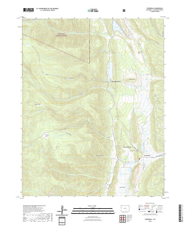
2022 Map of Stonewall
USGS Topo · Published 2022About this map
The dramatic vertical rock formation known as The Stonewall dominates the landscape near the community of Stonewall, where the Middle Fork Purgatoire River cuts through the namesake Stonewall Gap. This modern survey reveals a region defined by its water resources and varied terrain, including high-altitude features like North Lake, South Lake, and the Duling Lakes perched above Duling Park. The human imprint is centered around the Stonewall Valley, where the Stonewall Cem and Russell Reservoir sit near the junction of Hwy 12 and several county roads. Within the San Isabel National Forest, the map traces complex drainage systems from Whiskey Cr to the W Fork N Fork Purgatoire River, alongside historical land management markers such as the Maxwell Ditch Number 19 and 20.
Find a feature on this map
49 named features on this map. Tap any name to fly to it.
Don’t see what you’re looking for? This feature index may not catch every label — zoom into the map to look around manually.
Map Details
Editions of this 2022 Stonewall Map
This is the sole edition of this map. No revisions or reprints were ever made.
Other maps of this area

1891 · Spanish Peaks
USGS Topo · 1:125,000

1893 · Spanish Peaks
USGS Topo · 1:125,000

1895 · Spanish Peaks
USGS Topo · 1:125,000

1897 · Spanish Peaks
USGS Topo · 1:125,000

1900 · Spanish Peaks
USGS Topo · 1:125,000

1954 · Trinidad
USGS Topo · 1:250,000

1955 · Trinidad
USGS Topo · 1:250,000

1958 · Trinidad
USGS Topo · 1:250,000

1959 · Trinidad
USGS Topo · 1:250,000
1967 · Cucharas Pass
USGS Topo · 1:24,000