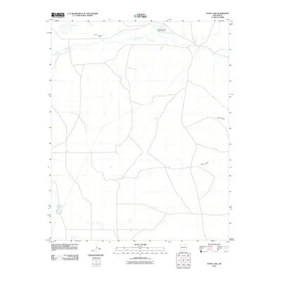
2010 Map of Stony Lake
USGS Topo · Published 2010About this map
Red River Ranch and the small settlement of Daniels sit at the northern edge of this high-plains landscape, where the waters of Ocate Creek wind eastward through Colfax County. The map documents a ranching environment defined by water management and natural catchments, featuring the Red River Cattle Company Dam which forms Ferguson Lake. To the south, the namesake Stony Lake remains a prominent landmark amidst a network of unimproved roads and ephemeral basins like Dry Laguna. The terrain is further defined by the drainage patterns leading into Pup Canyon and Dog Canyon on the eastern side of the quadrangle. This 2010 survey reflects the enduring cattle-ranching heritage of northern New Mexico, illustrating how contemporary land use continues to follow the reliable water sources established by early twentieth-century operations.
Find a feature on this map
9 named features on this map. Tap any name to fly to it.
Don’t see what you’re looking for? This feature index may not catch every label — zoom into the map to look around manually.
Map Details
Editions of this 2010 Stony Lake Map
This is the sole edition of this map. No revisions or reprints were ever made.
Other maps of this area

1954 · Raton
USGS Topo · 1:250,000

1958 · Raton
USGS Topo · 1:250,000

1964 · Stony Lake
USGS Topo · 1:24,000

1964 · Wagon Mound
USGS Topo · 1:24,000

1964 · Alto De Hormiga
USGS Topo · 1:24,000

1964 · Colmor
USGS Topo · 1:24,000

1964 · Pinon Hills
USGS Topo · 1:24,000

1965 · Taylor Springs
USGS Topo · 1:24,000

1965 · Springer
USGS Topo · 1:24,000

1972 · Canon Colorado
USGS Topo · 1:24,000