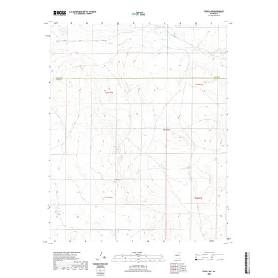
2020 Map of Stony Lake
USGS Topo · Published 2020About this map
The Colfax Co Mora Co boundary line bisects this high-elevation landscape, where the drainage systems of the Sangre de Cristo foothills begin to define the terrain. Ocate Cr meanders across the northern section, feeding into Ferguson Lake and passing near the ephemeral Dry Laguna. The topography is marked by deep incisions, most notably Dog Canyon and Pup Canyon, which provide a clear view of the erosion patterns characteristic of this part of New Mexico. In the southwest corner, the namesake Stony Lake sits as a primary landmark. Infrastructure is minimal, consisting largely of Co RD C-4, reflecting the rural and ranch-oriented nature of the borderlands between Colfax and Mora counties. This 2020 edition provides precise modern topography for a region defined by its rugged watercourses and seasonal basins.
Find a feature on this map
12 named features on this map. Tap any name to fly to it.
Don’t see what you’re looking for? This feature index may not catch every label — zoom into the map to look around manually.
Map Details
Editions of this 2020 Stony Lake Map
This is the sole edition of this map. No revisions or reprints were ever made.
Other maps of this area

1954 · Raton
USGS Topo · 1:250,000

1958 · Raton
USGS Topo · 1:250,000

1964 · Stony Lake
USGS Topo · 1:24,000

1964 · Wagon Mound
USGS Topo · 1:24,000

1964 · Alto De Hormiga
USGS Topo · 1:24,000

1964 · Colmor
USGS Topo · 1:24,000

1964 · Pinon Hills
USGS Topo · 1:24,000

1965 · Taylor Springs
USGS Topo · 1:24,000

1965 · Springer
USGS Topo · 1:24,000

1972 · Canon Colorado
USGS Topo · 1:24,000