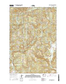
2017 Map of Stony Mountain
USGS Topo · Published 2017About this map
Stony Mtn and Green Top anchor this part of the Coast Range, where the drainage systems of Willamina Creek and Beaver Cr have shaped the settlement patterns of Yamhill and Tillamook counties. The landscape is defined by its rural valley floors and timbered ridges, connected by an intricate network of local routes like Smithville Rd and Gopher Valley Rd. For local historians, the presence of three distinct burial sites—Highland Cem, Hussey Cem, and Buck Hollow Cem—offers specific geographic markers for genealogical research in this region. The map also reveals specialized land use at Poverty Hollow Airport and identifies unique water sources such as La Toutena Mary Spring, reflecting the essential relationship between the area's geography and its isolated homesteads and small communities like Buck Hollow.
Find a feature on this map
39 named features on this map. Tap any name to fly to it.
Don’t see what you’re looking for? This feature index may not catch every label — zoom into the map to look around manually.
Map Details
Editions of this 2017 Stony Mountain Map
This is the sole edition of this map. No revisions or reprints were ever made.
Other maps of this area

1942 · Ginger Peak
USGS Topo · 1:62,500

1942 · Sheridan
USGS Topo · 1:62,500

1942 · Spirit Mtn
USGS Topo · 1:62,500

1942 · Fairdale
USGS Topo · 1:62,500

1948 · Vancouver
USGS Topo · 1:250,000

1950 · Vancouver
USGS Topo · 1:250,000

1950 · Vancouver
USGS Topo · 1:250,000

1955 · Blaine
USGS Topo · 1:62,500

1955 · Fairdale
USGS Topo · 1:62,500

1955 · Grand Ronde
USGS Topo · 1:62,500