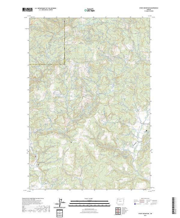
2023 Map of Stony Mountain
USGS Topo · Published 2023About this map
Stony Mountain dominates the center of this coastal range landscape, marking the high ground where Tillamook Co meets Yamhill Co. The terrain is defined by a dense network of drainages including Willamina Creek and Beaver Creek, with deep ravines like Buck Hollow cutting through the forested ridges. Human activity is concentrated along the lower valley floors to the east and south, where roads follow the natural contours of Gopher Valley and the banks of Deer Creek. This modern survey records essential landmarks for local history, including the Poverty Hollow Airport and several historic burial sites such as Hussey Cem, Highland Cem, and Buck Hollow Cem. The road network, including Peavine Rd and Gopher Valley Rd, illustrates the continued importance of these corridors for accessing the timberlands and rural properties of northwest Oregon.
Find a feature on this map
35 named features on this map. Tap any name to fly to it.
Don’t see what you’re looking for? This feature index may not catch every label — zoom into the map to look around manually.
Map Details
Editions of this 2023 Stony Mountain Map
This is the sole edition of this map. No revisions or reprints were ever made.
Other maps of this area

1942 · Ginger Peak
USGS Topo · 1:62,500

1942 · Sheridan
USGS Topo · 1:62,500

1942 · Spirit Mtn
USGS Topo · 1:62,500

1942 · Fairdale
USGS Topo · 1:62,500

1948 · Vancouver
USGS Topo · 1:250,000

1950 · Vancouver
USGS Topo · 1:250,000

1950 · Vancouver
USGS Topo · 1:250,000

1955 · Blaine
USGS Topo · 1:62,500

1955 · Fairdale
USGS Topo · 1:62,500

1955 · Grand Ronde
USGS Topo · 1:62,500