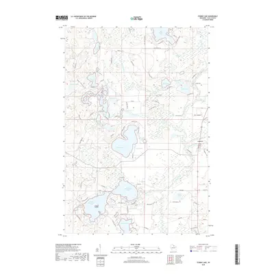
2018 Map of Stormy Lake
USGS Topo · Published 2018About this map
The Wisconsin River winds through this lake-rich portion of Vilas County, where the landscape is defined by glacial kettle lakes and a network of game trails. The settlement of Conover sits on the eastern edge of the quadrangle, serving as the primary hub for the surrounding seasonal and year-round waterfront properties. Water bodies dominate the geography, ranging from the large expanses of Stormy Lake and Lower Buckatabon Lake to smaller, curiously named features like Nudist Lake and Portage Spring.
Find a feature on this map
93 named features on this map. Tap any name to fly to it.
Don’t see what you’re looking for? This feature index may not catch every label — zoom into the map to look around manually.
Map Details
Editions of this 2018 Stormy Lake Map
This is the sole edition of this map. No revisions or reprints were ever made.
Other maps of this area

1928 · Three Lakes
USGS Topo · 1:48,000

1930 · Robbins
USGS Topo · 1:48,000

1938 · Phelps
USGS Topo · 1:48,000

1938 · Three Lakes
USGS Topo · 1:48,000

1938 · Robbins
USGS Topo · 1:48,000

1945 · Three Lakes
USGS Topo · 1:48,000

1945 · Robbins
USGS Topo · 1:48,000

1946 · Star Lake
USGS Topo · 1:48,000

1950 · Phelps
USGS Topo · 1:48,000

1950 · Star Lake
USGS Topo · 1:48,000