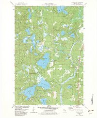
1982 Map of Stormy Lake
USGS Topo · Published 1982About this map
Glacial lake systems and the Chicago and North Western corridor define the landscape of Conover in this early 1980s survey. The topography is dominated by an intricate network of kettle lakes and flowages, ranging from the sprawling Stormy Lake and Big Portage Lake in the north to the connected waters of Upper Buckatabon Lake and Lower Buckatabon Lake in the south. The village of Conover serves as the primary hub, where Chicago Ave and Old 45 Road meet at the rail line near Community Park.
Find a feature on this map
52 named features on this map. Tap any name to fly to it.
Don’t see what you’re looking for? This feature index may not catch every label — zoom into the map to look around manually.
Map Details
Editions of this 1982 Stormy Lake Map
This is the sole edition of this map. No revisions or reprints were ever made.
Other maps of this area

1928 · Three Lakes
USGS Topo · 1:48,000

1930 · Robbins
USGS Topo · 1:48,000

1938 · Phelps
USGS Topo · 1:48,000

1938 · Three Lakes
USGS Topo · 1:48,000

1938 · Robbins
USGS Topo · 1:48,000

1945 · Three Lakes
USGS Topo · 1:48,000

1945 · Robbins
USGS Topo · 1:48,000

1946 · Star Lake
USGS Topo · 1:48,000

1950 · Phelps
USGS Topo · 1:48,000

1950 · Star Lake
USGS Topo · 1:48,000