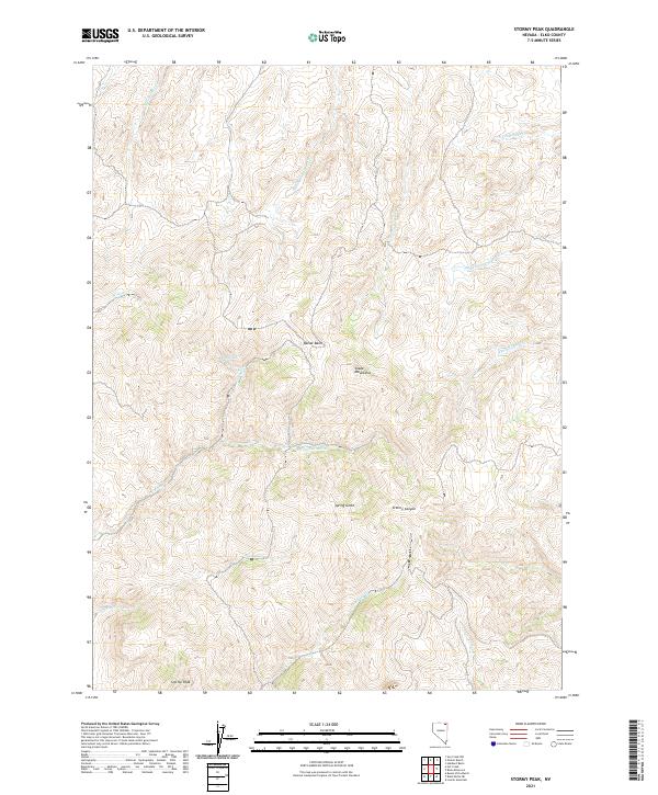
2021 Map of Stormy Peak
USGS Topo · Published 2021About this map
Stormy Peak stands as the prominent landmark in this high-elevation landscape within the Snake Mountains of Elko County. This 2021 survey illustrates a complex watershed where numerous seasonal and perennial streams originate, including the headwaters of Stormy Cr, Spring Cr, and the various forks of Deer Cr. The terrain is defined by dramatic elevation changes, moving from the depths of Stormy Canyon and Spring Gulch up to the high alpine reaches of Balsac Basin.
Find a feature on this map
24 named features on this map. Tap any name to fly to it.
Don’t see what you’re looking for? This feature index may not catch every label — zoom into the map to look around manually.
Map Details
Editions of this 2021 Stormy Peak Map
This is the sole edition of this map. No revisions or reprints were ever made.
Other maps of this area

1955 · Wells
USGS Topo · 1:250,000

1958 · Wells
USGS Topo · 1:250,000

1961 · Wells
USGS Topo · 1:250,000

1967 · Buena Vista Ranch
USGS Topo · 1:24,000

1967 · Black Butte NE
USGS Topo · 1:24,000

1968 · Hubbard Basin
USGS Topo · 1:24,000
1968 · Loomis Mtn
USGS Topo · 1:24,000

1968 · Hot Creek
USGS Topo · 1:24,000
1968 · Boies Reservoir
USGS Topo · 1:24,000
1968 · Stormy Peak
USGS Topo · 1:24,000