
1968 Map of Hot Creek
USGS Topo · Published 1972About this map
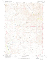
Marys River and its intricate network of tributaries define the high desert topography of Elko County in the late 1960s. The map illustrates a landscape shaped by water and ranching, where small-scale homesteading and livestock operations are anchored to reliable springs. Working family sites like Gibbs Ranch, the Anderson Homestead, and Dixons Marys River Ranch appear along the valley floors, connected by unimproved trails that follow the natural drainage of Wildcat Creek and Currant Creek.
Find a feature on this map
21 named features on this map. Tap any name to fly to it.
Don’t see what you’re looking for? This feature index may not catch every label — zoom into the map to look around manually.
Map Details
Editions of this 1968 Hot Creek Map
2 editions found
Other maps of this area

1955 · Wells
USGS Topo · 1:250,000

1958 · Wells
USGS Topo · 1:250,000

1961 · Wells
USGS Topo · 1:250,000

1967 · Buena Vista Ranch
USGS Topo · 1:24,000

1967 · Black Butte NE
USGS Topo · 1:24,000

1967 · Hanks Creek NE
USGS Topo · 1:24,000

1968 · Marys River Basin NE
USGS Topo · 1:24,000

1968 · Marys River Basin SE
USGS Topo · 1:24,000
1968 · Stormy Peak
USGS Topo · 1:24,000
1968 · Gilmer Ranch
USGS Topo · 1:24,000