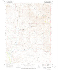
1968 Map of Hot Creek
USGS Topo · Published 1978About this map
Dixons Marys River Ranch and the Anderson Homestead mark the sparse human footprint in this high-desert drainage during the late 1960s. The landscape is defined by the convergence of several drainages, including Wildcat Creek, Hot Creek, and Currant Creek, which flow toward the southern reaches of the Marys River. This network of intermittent streams and scattered water sources like Bathtub Spring supported a ranching economy reliant on local topography, as evidenced by several dams and corrals situated near vital watering holes.
Find a feature on this map
21 named features on this map. Tap any name to fly to it.
Don’t see what you’re looking for? This feature index may not catch every label — zoom into the map to look around manually.
Map Details
Editions of this 1968 Hot Creek Map
2 editions found
Other maps of this area

1955 · Wells
USGS Topo · 1:250,000

1958 · Wells
USGS Topo · 1:250,000

1961 · Wells
USGS Topo · 1:250,000

1967 · Buena Vista Ranch
USGS Topo · 1:24,000

1967 · Black Butte NE
USGS Topo · 1:24,000

1967 · Hanks Creek NE
USGS Topo · 1:24,000

1968 · Marys River Basin NE
USGS Topo · 1:24,000

1968 · Marys River Basin SE
USGS Topo · 1:24,000

1968 · Hot Creek
USGS Topo · 1:24,000
1968 · Stormy Peak
USGS Topo · 1:24,000