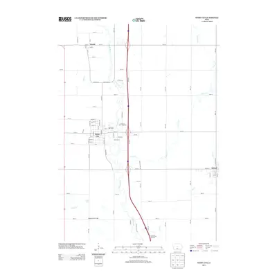
2013 Map of Story City
USGS Topo · Published 2013About this map
The S Skunk River carves a winding path through the center of this central Iowa landscape, defining the layout of Story City and its surrounding agricultural terrain. By 2013, the region demonstrates a mix of established municipal grids and modern recreational development, evidenced by the Riverbend Golf Course and the Whispering Oaks Campground situated near the riverbanks. The settlement of Roland sits to the east, while Randall is positioned in the northern reaches, connected by a network of sectional roads and the prominent north-south transit corridor. Notable water features like Long Dick Cr, Bear Cr, and Keigley Br drain the fertile plains into the river system. Local infrastructure is highlighted by landmarks such as the Keigley Branch Bridge near Comar Lake, illustrating the intersection of natural hydrology and human transit in Story County.
Find a feature on this map
82 named features on this map. Tap any name to fly to it.
Don’t see what you’re looking for? This feature index may not catch every label — zoom into the map to look around manually.
Map Details
Editions of this 2013 Story City Map
This is the sole edition of this map. No revisions or reprints were ever made.
Other maps of this area

1912 · Ames
USGS Topo · 1:62,500

1914 · Ames
USGS Topo · 1:62,500

1954 · Waterloo
USGS Topo · 1:250,000

1955 · Waterloo
USGS Topo · 1:250,000

1975 · Ames NW
USGS Topo · 1:24,000

1975 · Nevada
USGS Topo · 1:24,000

1975 · Ames West
USGS Topo · 1:24,000

1975 · Story City
USGS Topo · 1:24,000
1975 · Ames East
USGS Topo · 1:24,000

1975 · Mc Callsburg
USGS Topo · 1:24,000