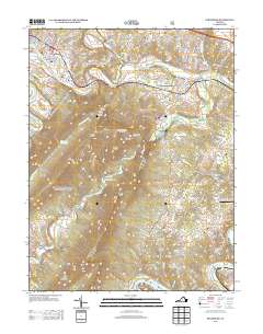
2013 Map of Strasburg
USGS Topo · Published 2013About this map
Strasburg serves as a focal point where the N Fork Shenandoah River bends through the valley, flanked by the prominent elevations of Three Top Mountain and Signal Knob. This modern survey details a landscape where industrial heritage meets contemporary recreation, showing the site of the historical Elizabeth Furnace and Wakeman Mill alongside the Front Royal-Warren County Airport and the Skyline Ranch Resort. The geography is defined by the winding courses of Passage Cr and Cedar Cr, which cut through the ridges near Meneka Peak and High Peak. Notable local features include several named river crossings such as Bowmans Ford and Buckton Ford, providing insight into the traditional routes through this part of Shenandoah County. Small settlements and clusters like Sandy Hook, Waterlick, and Shenandoah River Lakes are distributed throughout the surrounding farm and forest lands.
Find a feature on this map
62 named features on this map. Tap any name to fly to it.
Don’t see what you’re looking for? This feature index may not catch every label — zoom into the map to look around manually.
Map Details
Editions of this 2013 Strasburg Map
This is the sole edition of this map. No revisions or reprints were ever made.
Other maps of this area

1893 · Luray
USGS Topo · 1:125,000

1894 · Winchester
USGS Topo · 1:125,000

1905 · Luray
USGS Topo · 1:125,000

1923 · Middletown
USGS Topo · 1:62,500

1937 · Middletown
USGS Topo · 1:48,000

1938 · Winchester
USGS Topo · 1:48,000

1939 · Front Royal
USGS Topo · 1:48,000

1942 · Winchester
USGS Topo · 1:62,500

1943 · Middletown
USGS Topo · 1:62,500

1944 · Front Royal
USGS Topo · 1:62,500