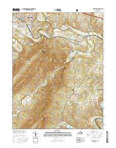
2016 Map of Strasburg
USGS Topo · Published 2016About this map
Strasburg serves as the gateway to the massive ridges of the George Washington National Forest, where the terrain rises sharply from the North Fork Shenandoah River toward heights like Signal Knob and Meneka Peak. The landscape is defined by the narrow corridors of Fort Valley and Page Valley, containing a network of rural settlements such as Waterlick, Buckton, and Bethel. Along the river valley and the foothills of Three Top Mtn, numerous family and church burial sites including Zion Cem, Richardson Cem, and Bennetts Chapel Cem are documented. Significant protected land is visible to the north within the Cedar Creek and Belle Grove National Historical Park, illustrating the region's dense intersection of geological features and early American history.
Find a feature on this map
128 named features on this map. Tap any name to fly to it.
Don’t see what you’re looking for? This feature index may not catch every label — zoom into the map to look around manually.
Map Details
Editions of this 2016 Strasburg Map
This is the sole edition of this map. No revisions or reprints were ever made.
Other maps of this area

1893 · Luray
USGS Topo · 1:125,000

1894 · Winchester
USGS Topo · 1:125,000

1905 · Luray
USGS Topo · 1:125,000

1923 · Middletown
USGS Topo · 1:62,500

1937 · Middletown
USGS Topo · 1:48,000

1938 · Winchester
USGS Topo · 1:48,000

1939 · Front Royal
USGS Topo · 1:48,000

1942 · Winchester
USGS Topo · 1:62,500

1943 · Middletown
USGS Topo · 1:62,500

1944 · Front Royal
USGS Topo · 1:62,500