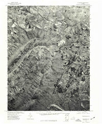
1972 Map of Strasburg
USGS Topo · Published 1977About this map
Strasburg anchors the northwestern corner of this 1972 orthophotograph, where the town's grid of streets and historical development meet the winding course of the North Fork Shenandoah River. This aerial perspective, captured in early spring before full leaf-out, provides an unusually clear view of the complex geological folding in the Massanutten Mountain range that dominates the central and southern portions of the quadrangle. The imagery reveals the sharp contrast between the dense woodlands of the ridgelines and the cleared agricultural fields along the river valley and near the community of Waterlick to the east. By utilizing early 1970s aerial photography, this survey documents the land use and transportation corridors of the Shenandoah Valley at a time of transitioning rural industry.
Find a feature on this map
3 named features on this map. Tap any name to fly to it.
Don’t see what you’re looking for? This feature index may not catch every label — zoom into the map to look around manually.
Map Details
Editions of this 1972 Strasburg Map
This is the sole edition of this map. No revisions or reprints were ever made.
Other maps of this area

1893 · Luray
USGS Topo · 1:125,000

1894 · Winchester
USGS Topo · 1:125,000

1905 · Luray
USGS Topo · 1:125,000

1923 · Middletown
USGS Topo · 1:62,500

1937 · Middletown
USGS Topo · 1:48,000

1938 · Winchester
USGS Topo · 1:48,000

1939 · Front Royal
USGS Topo · 1:48,000

1942 · Winchester
USGS Topo · 1:62,500

1943 · Middletown
USGS Topo · 1:62,500

1944 · Front Royal
USGS Topo · 1:62,500