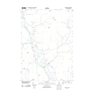
2012 Map of Stratford
USGS Topo · Published 2012About this map
The Connecticut River carves a winding path through this northern New England landscape, serving as the border between Stratford, New Hampshire, and Maidstone, Vermont. Small riverfront settlements such as Beatties, Masons, and Mapleton are linked by a network of rural roads that follow the valley floor, including Maidstone Lake Rd and Cheever Rd. The eastern terrain is dominated by the foothills of the White Mountains, with prominent peaks like Spruce Mountain and Goback Mountain overlooking the valley. Genealogists can identify significant local burial sites such as the Smith-Gardner Shoff Cem and Taylor Cem. The area's hydrology is characterized by numerous small ponds and tributaries, including Stratford Bog Pond and Hoskins Pond, which drain the surrounding highlands like Teapot Mountain and Bear Mountain.
Find a feature on this map
75 named features on this map. Tap any name to fly to it.
Don’t see what you’re looking for? This feature index may not catch every label — zoom into the map to look around manually.
Map Details
Editions of this 2012 Stratford Map
This is the sole edition of this map. No revisions or reprints were ever made.
Other maps of this area

1920 · Guildhall
USGS Topo · 1:62,500

1929 · Averill
USGS Topo · 1:62,500

1930 · Percy
USGS Topo · 1:62,500

1930 · Dixville
USGS Topo · 1:62,500

1931 · Guildhall
USGS Topo · 1:48,000

1933 · Guildhall
USGS Topo · 1:48,000

1933 · Dixville
USGS Topo · 1:62,500

1934 · Percy
USGS Topo · 1:62,500

1934 · Dixville
USGS Topo · 1:62,500

1937 · Guildhall
USGS Topo · 1:62,500