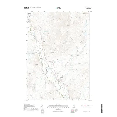
2018 Map of Stratford
USGS Topo · Published 2018About this map
Connecticut River crossings and mountain gaps define this corridor along the New Hampshire and Vermont border. The valley settlements of North Stratford, Beatties, Masons, and Stratford are positioned near the river, while the landscape rises sharply to the east toward Teapot Mtn and Savage Mtn. Local genealogy is anchored by the Smith-Gardner-Shoff Cem and Taylor Cem, marking the long-standing family lines in this borderland. The topography is punctuated by Stratford Notch in the northeast and several significant water bodies, including Hoskins Pond and Paul Stream Pond. The transport network follows the valley floors, with routes like Hogback Rd and Percy Rd connecting the river communities to the higher timberlands and interior peaks like Spruce Mtn and Willard Mtn.
Find a feature on this map
82 named features on this map. Tap any name to fly to it.
Don’t see what you’re looking for? This feature index may not catch every label — zoom into the map to look around manually.
Map Details
Editions of this 2018 Stratford Map
This is the sole edition of this map. No revisions or reprints were ever made.
Other maps of this area

1920 · Guildhall
USGS Topo · 1:62,500

1929 · Averill
USGS Topo · 1:62,500

1930 · Percy
USGS Topo · 1:62,500

1930 · Dixville
USGS Topo · 1:62,500

1931 · Guildhall
USGS Topo · 1:48,000

1933 · Guildhall
USGS Topo · 1:48,000

1933 · Dixville
USGS Topo · 1:62,500

1934 · Percy
USGS Topo · 1:62,500

1934 · Dixville
USGS Topo · 1:62,500

1937 · Guildhall
USGS Topo · 1:62,500