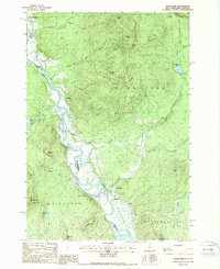
1988 Map of Stratford
USGS Topo · Published 1988About this map
The Connecticut River serves as the winding border between Coos County, New Hampshire, and Essex County, Vermont, in this 1980s topographic study. The landscape is defined by the tight valley settlements of North Stratford, Stratford, and Maidstone, where the river’s oxbows and floodplains meet the rising slopes of Savage Mtn and Willard Mtn. Small communities like Hinman, Beatties, and Mapleton dot the riverbanks, linked by the primary road network and an Old RR Grade that speaks to the area's historical rail dependence.
Find a feature on this map
49 named features on this map. Tap any name to fly to it.
Don’t see what you’re looking for? This feature index may not catch every label — zoom into the map to look around manually.
Map Details
Editions of this 1988 Stratford Map
This is the sole edition of this map. No revisions or reprints were ever made.
Other maps of this area

1920 · Guildhall
USGS Topo · 1:62,500

1929 · Averill
USGS Topo · 1:62,500

1930 · Percy
USGS Topo · 1:62,500

1930 · Dixville
USGS Topo · 1:62,500

1931 · Guildhall
USGS Topo · 1:48,000

1933 · Guildhall
USGS Topo · 1:48,000

1933 · Dixville
USGS Topo · 1:62,500

1934 · Percy
USGS Topo · 1:62,500

1934 · Dixville
USGS Topo · 1:62,500

1937 · Guildhall
USGS Topo · 1:62,500