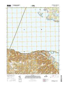
2016 Map of Stratford Hall
USGS Topo · Published 2016About this map
Stratford Hall stands as the centerpiece of this coastal Virginia landscape, where the southern shore of the Potomac River meets the prominent Stratford Cliffs. The map illustrates a region defined by its colonial-era legacy and water-oriented economy, featuring historic sites like Stratford Mill and the nearby Stratford Millpond. Across the river in Maryland, the settlements of River Springs, Palmers, and Coltons Point occupy the fingers of land reaching into Saint Catherine Sound. Inland from the Virginia bluffs, the terrain is carved by numerous drainages such as Big Meadow Run and Black Swamp, supporting small communities like Bryant Town and Chiltons. This detailed survey shows how modern road networks, including Stratford Hall Rd and Currioman Rd, connect these long-established landings and family seats to the broader Northern Neck and Southern Maryland peninsulas.
Find a feature on this map
94 named features on this map. Tap any name to fly to it.
Don’t see what you’re looking for? This feature index may not catch every label — zoom into the map to look around manually.
Map Details
Editions of this 2016 Stratford Hall Map
This is the sole edition of this map. No revisions or reprints were ever made.
Other maps of this area

1892 · Leonardtown
USGS Topo · 1:62,500

1892 · Piney Point
USGS Topo · 1:62,500

1892 · Montross
USGS Topo · 1:62,500

1894 · Wicomico
USGS Topo · 1:62,500

1894 · Piney Point
USGS Topo · 1:62,500

1895 · Wicomico
USGS Topo · 1:62,500

1895 · Leonardtown
USGS Topo · 1:62,500

1895 · Nomini
USGS Topo · 1:125,000

1895 · Piney Point
USGS Topo · 1:62,500

1895 · Montross
USGS Topo · 1:62,500