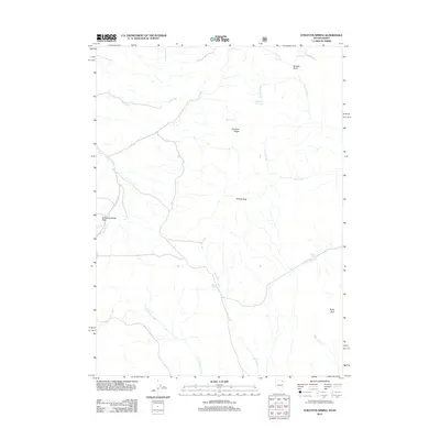
2012 Map of Stratton Spring
USGS Topo · Published 2012About this map
Stratton Spring and the surrounding high-desert drainage systems of Twin Falls County are meticulously documented in this 2012 U.S. Geological Survey study. The landscape is defined by its critical water sources, including Line Spring, Mud Spring, and Summit Spring, which provide life to an otherwise arid terrain near the Idaho-Nevada border. These springs feed into a complex network of seasonal and perennial waterways such as Fall Creek, Stratton Creek, and Coon Creek, illustrating the natural irrigation patterns that have long dictated land use in this part of the West. Notable topographical markers like Deadline Ridge, Eclipse Rock, and Rocky Peak provide orientation across the sagebrush-covered draws, while the presence of Horse Creek suggests the enduring routes used for travel and ranching. The map offers a clear view of the geographic isolation and the vital importance of water rights and named landmarks in the high plateau country.
Find a feature on this map
18 named features on this map. Tap any name to fly to it.
Don’t see what you’re looking for? This feature index may not catch every label — zoom into the map to look around manually.
Map Details
Editions of this 2012 Stratton Spring Map
This is the sole edition of this map. No revisions or reprints were ever made.
Other maps of this area

1955 · Twin Falls
USGS Topo · 1:250,000

1955 · Wells
USGS Topo · 1:250,000

1958 · Wells
USGS Topo · 1:250,000

1958 · Twin Falls
USGS Topo · 1:250,000

1961 · Wells
USGS Topo · 1:250,000

1961 · Gollaher Mountain
USGS Topo · 1:62,500

1961 · Goose Creek
USGS Topo · 1:62,500

1977 · Timber Butte
USGS Topo · 1:24,000

1977 · Big Creek Ranch
USGS Topo · 1:24,000

1977 · Mahogany Butte
USGS Topo · 1:24,000